
Archives of Manitoba
Spotlight: HBCA in words and images
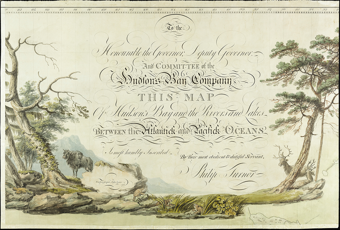
Philip Turnor's Map
enlarge image full size
In 1794, Philip Turnor created a large composite map, inscribed To the Honourable the Governor, Deputy Governor, And Committee of the Hudson's Bay Company This Map Of Hudson's Bay and the Rivers and Lakes Between the Atlantick and Pacifick Oceans Is most humbly Inscribed By Their most obedient & dutiful Servant, Philip Turnor. This was at the end of his career as the Hudson’s Bay Company’s (HBC’s) first official surveyor, and the map exhibited most of the first inland exploratory knowledge collected by the HBC at the time.
enlarge image full size
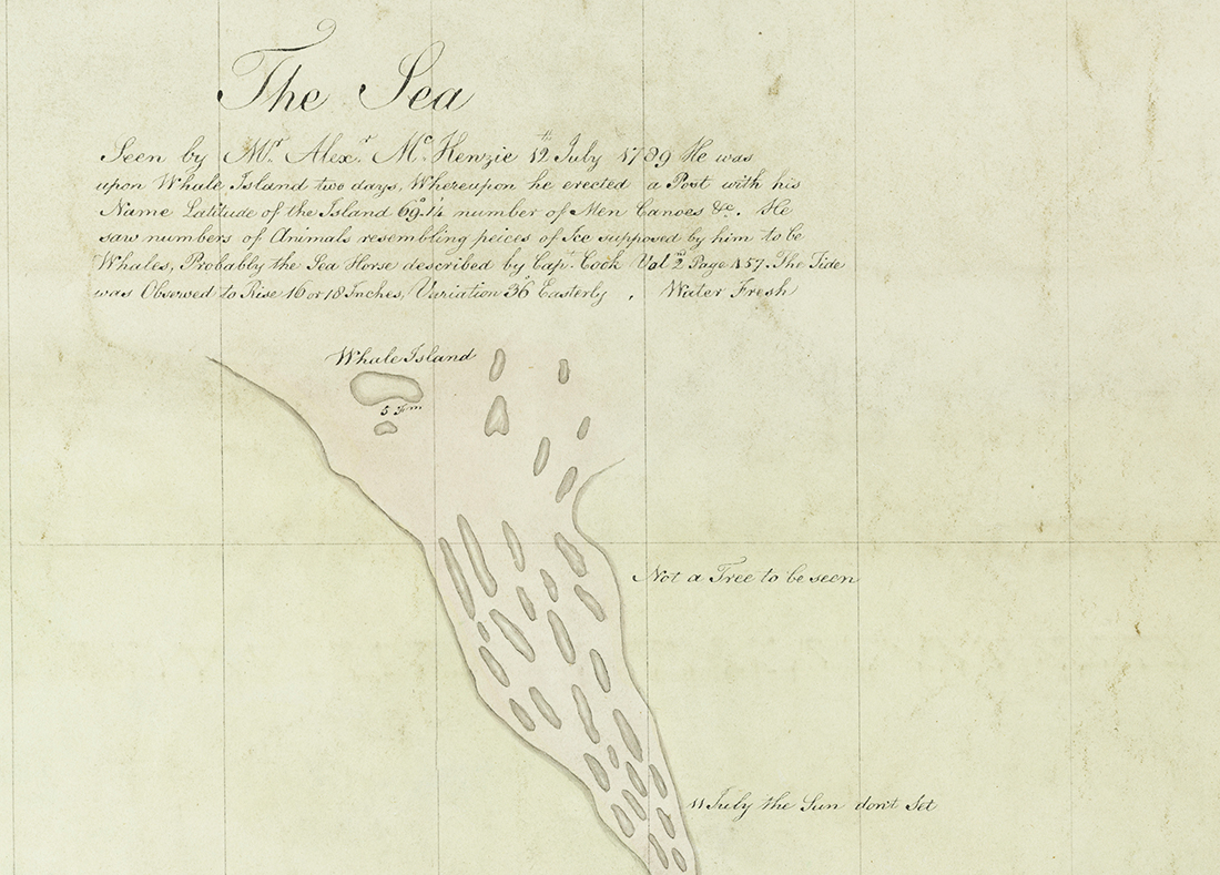
Philip Turnor started his career with the HBC in 1778. At this time, the HBC desired to expand its presence into the interior of North America. After completing his first task of surveying the grounds of York Factory, Turnor was charged with inland surveys branching out from York, Albany and Moose Factories, resulting in six survey maps of the river routes emanating from these posts. From 1782 until 1787, Turnor settled into the role of HBC postmaster at Brunswick House, then Frederick House, before leaving for England. He returned to North America in 1789 and spent the winter teaching surveying to his successors, David Thompson and Peter Fidler. In 1790, Turnor once again set out on a survey expedition, destined for the Athabasca region.
The end result of Turnor’s survey work was creation of the composite map, which was received by the HBC’s Governor and Committee in London in January 1795. In thanks, Turnor was paid £100 for this work. Moreover, the London directors ordered that the case of Turnor’s watch which he used in his surveys be engraved with the HBC’s coat of arms. The map became the basis for Aaron Arrowsmith’s A Map Exhibiting all the New Discoveries in the Interior Parts of North America, published that same year.
Shortly after submitting the map, Philip Turnor retired from the HBC. He died on 1 March, 1800.
See past features in the Spotlight Archive.