Whitemud Watershed Conservation District |
 |
Back to Conservation Districts
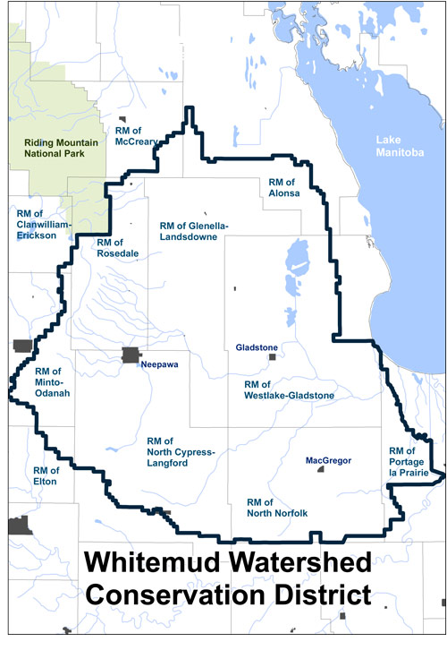
The Whitemud Watershed Conservation District (WWCD) was formed in 1972 as Manitoba’s first conservation district. It is 7,115 km² in size and includes all or part of the municipalities of Rosedale, Minto-Odanah, North Cypress-Langford, Westlake-Gladstone, Glenella-Landsdowne, Portage la Prairie, North Norfolk, Alonsa, McCreary and Clanwilliam.
The conservation district is located southeast of Riding Mountain National Park. Surface water and groundwater originate in the Riding Mountain Escarpment and Assiniboine Delta Aquifer respectively, and the Whitemud River flows east into Lake Manitoba.
The conservation district is responsible for maintaining more than 1,760 km of man-made waterways and associated crossings. Major activities include maintenance and replacement of waterway infrastructure. The district also delivers soil and water conservation programs, including: forage seed assistance, shelterbelt planting, grassed runways, water retention, shale traps, habitat preservation, conservation corridors, streambank stabilization and riparian management. The WWCD is currently developing an integrated watershed management plan for the Whitemud River Watershed.
Box 130, 41 Main Street East
Neepawa, Manitoba, R0J 1H0
204.476.5019 (P)
204.476.7094 (F)
www.whitemudwatershed.ca/
whitemud@mts.net