
East Souris River Integrated Watershed Management Plan
|
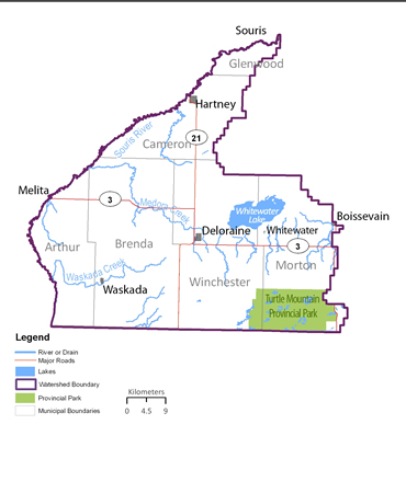
The East Souris River Integrated Watershed Management Plan encompasses the area of land which contributes water to the Souris River from the east, including tributaries such as Chain Lakes Creek, Medora Creek and Waskada Creek. The Turtle Mountain Conservation District led plan development in partnership with the provincial government and a team of supporting agencies, interest groups and watershed residents. East Souris River Integrated Watershed Management Plan - Second Generation Planning The East Souris River Integrated Watershed Management Plan, approved in 2006, was the first watershed plan to be completed in Manitoba. With 2016 marking the end of the 10 year implementation period of the plan, the Turtle Mountain Conservation District will again lead development of the 'second generation' of this plan. The planning process was initiated in the spring of 2017, and is a partnership with the provincial government and interested parties in the watershed.
|
|
|
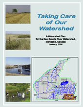
The East Souris integrated watershed management plan was completed in 2006. The completed plan can be viewed here. Once a plan is implemented the water planning authority can publish reports which track progress on achieving planning goals. |
|
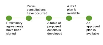
| In the development of an integrated watershed management plan the planning team invites a variety of groups to comment on issues important to them in the watershed. |
|
Public consultations are held to better understand the concerns and issues of the watershed. The planning team invites watershed residents through a variety of announcements. If public consultations have occurred, the results of the issues discussed at public consultations are summarized here.