|
|
|
|
|||||||||||||||||
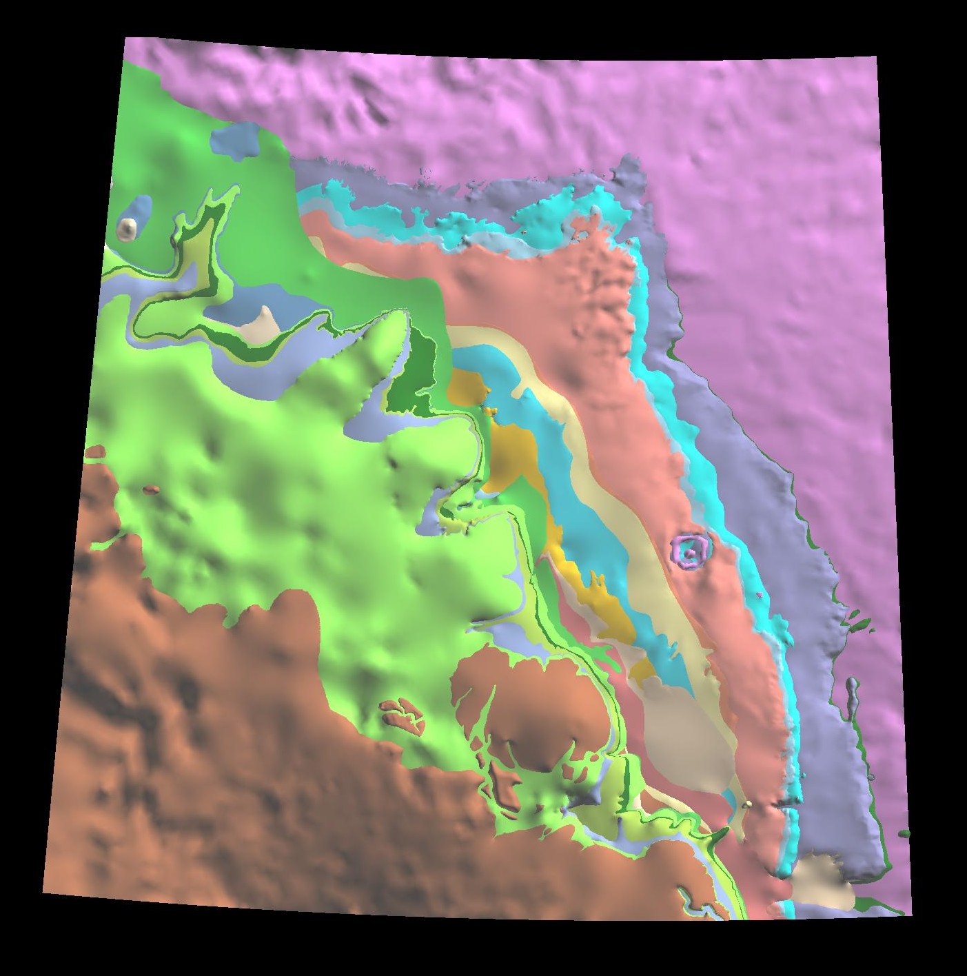
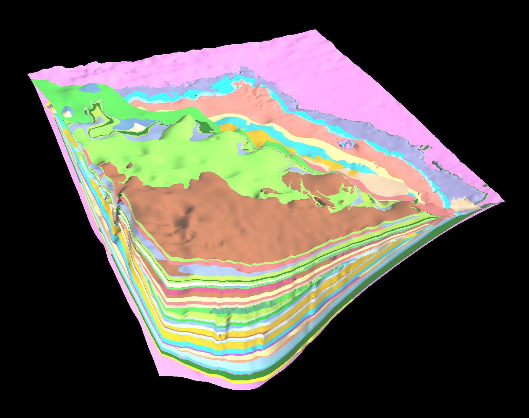
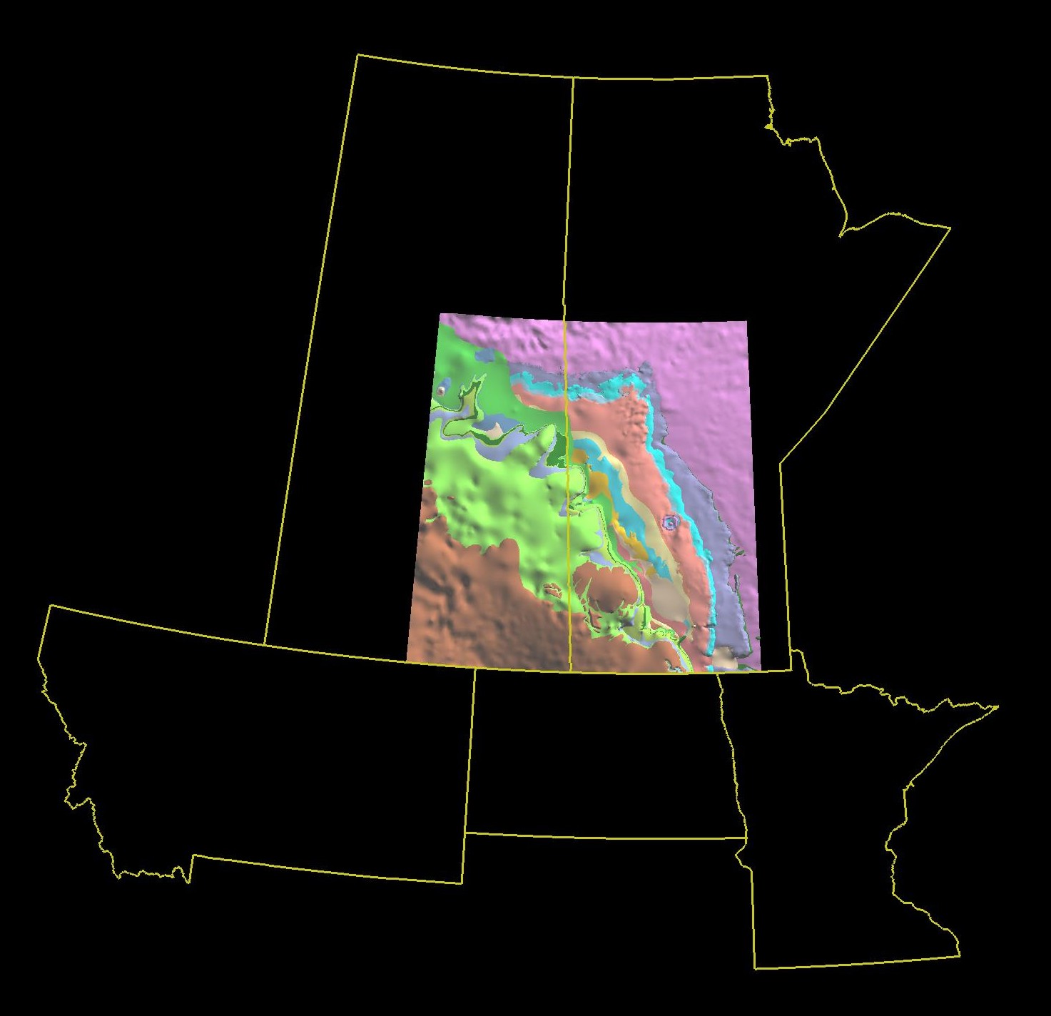
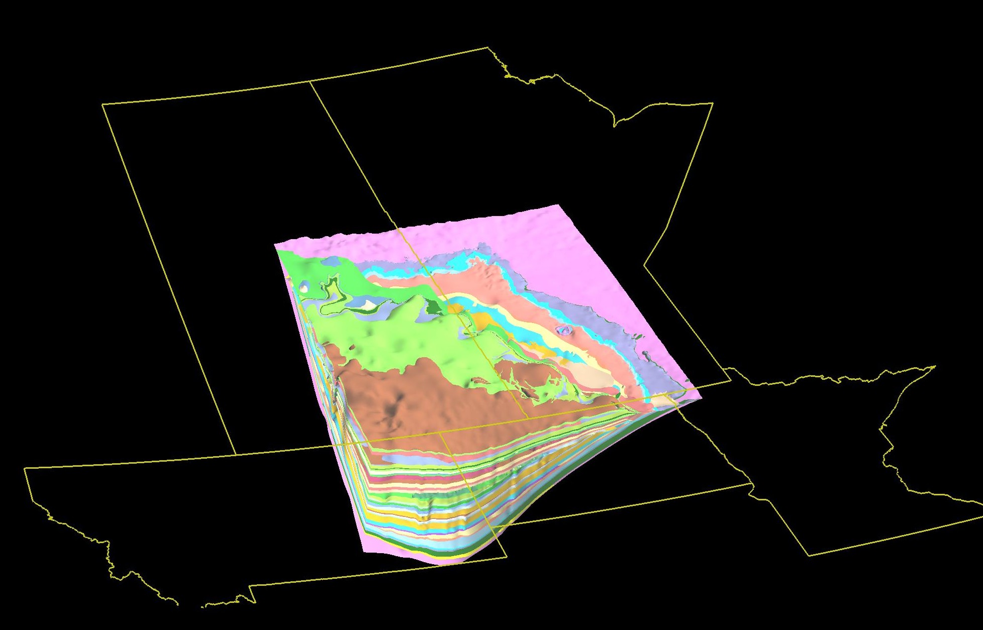
Williston Basin 3D Geological ModelThe TGI Williston Basin 3D Geological model is based on a database of unit tops picked by geologists from selected drillholes penetrating the majority of the post-Precambrian stratigraphy and mapped unit edges derived from legacy mapping and drillhole intercepts. On average, five wells per township were selected from areas with sufficient drillhole density. The 3D surfaces were constructed using these picked tops from a total of 9012 wells, which includes 5046 wells from Saskatchewan, 2606 wells from Manitoba, and to reduce edge-effects 771 wells from North Dakota and 589 from Montana. Of the 60 geological units in the TGI Williston Basin project, 42 were selected and modeled. The model was produced using Gocad earth modeling software. This model is entirely data driven with minimal human interpretation. Many fringe areas have a low data density, especially those areas close to unit edges. Because of this shortcoming, the expression of the unit edge (ie. escarpments) isn’t always accurately predicted.
The TGI team
was dedicated to maintaining accuracy and consistency in the picks
and modeled information presented, however due to the size of the
project, some errors may have been made. The TGI team is not liable
for these errors. The user of this information accepts all
responsibility for any work done on their part that uses all or part
of this data. (click images for higher resolution) Top down view – all modeled units (Precambrian to Cretaceous
Belly River Formation):
|
|