Geoscience
GIS Map Gallery
Geographic Information System
All extracted data from the Map Gallery are in Universal Transverse Mercator projection, zone 14, North American Datum 1983.
 Help Using the GIS Map Gallery Content
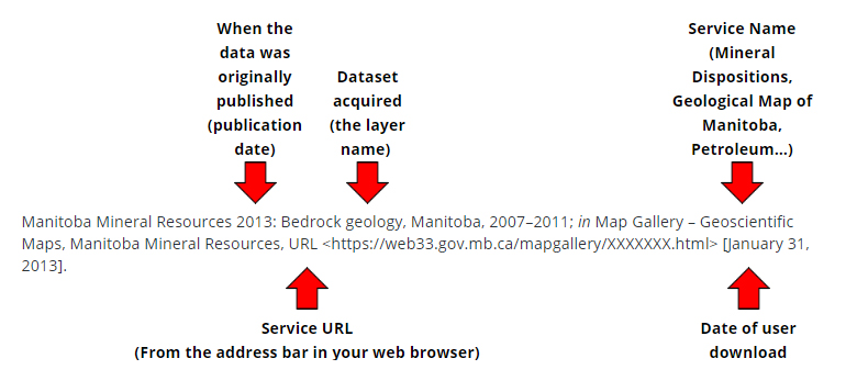
 Map Gallery data citation information
If you encounter any issues or have any questions about the Map Gallery, please contact Map Gallery Support.

Maps at various scales portraying the geology, geophysics, geochronology and mineral occurrences for Manitoba. Includes downloadable geophysical datasets. |

Includes: NOTE: For the most up to date information regarding mineral dispositions and leases, please use iMaQs or contact the Mines Branch. |

The Manitoba Petroleum Industry is located in the South Western corner of the province. This Petroleum map portrays well locations, oil field boundaries, Provincial oil and gas dispositions, Provincial mineral ownership, batteries and associated Facilities, seismic, geology & potash exploration permits. |
GIS Map Gallery citation example:
NOTE: Until formal metadata and statistics are collected and released, please use "2013" as the publication date for all Map Gallery citations.


