
GIS Map Gallery Geographic Information System
|
G/Gs – Glaciofluvial sand and gravel
Water flowing through glaciers cut channels and other landforms and, in the process, washed out the fine sediment from glacial till, leaving behind sand and gravel in glaciofluvial deposits, such as eskers (see two images in top left corner). Glaciofluvial sand and gravel is extremely important in the construction industry, providing aggregate for use in the construction of roads and buildings (Image 31). In Image 32, water flowing from left to right underneath a glacier in northern Manitoba cut a small channel and left behind a sand deposit in the bottom of the channel.
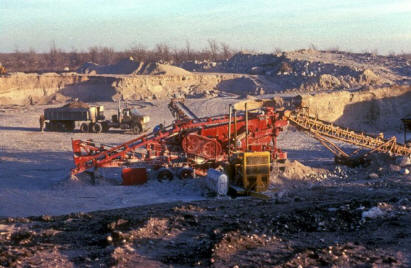 Image 31
|
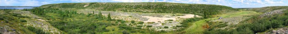 Image 32 |
 Back to Surficial Geology Compilation Map Series of Manitoba (SGCMS)