Narrows North
Municipal Authority
Rural Municipality of Alonsa
Crown Lands
Existing Subdivision
Location Map |
Road Map |
Subdivision Map |
Survey Plan |
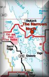
The Narrows North
Average Lot Size: 35 m x 65 m (may vary)
Getting There:
The Narrows North subdivision is located about 190 km northwest of Winnipeg on Lake Manitoba. From Winnipeg take PTH 6 approximately 130km, then go west on paved highway PTH 68 roughly 60 km to Lake Manitoba Narrows. For access to the subdivision follow the signage located off the highway.
Location and Description of Subdivision
This 98-lot subdivision is located on the northwest portion of Lake Manitoba. The average lot size is 35 m x 65 m. The Narrows North subdivision has a sand and cobblestone shoreline facing north on Lake Manitoba. Beach and boat launch facilities are presently located at Lake Manitoba Narrows Lodge located approximately 0.5 km away. There is also a boat launch located within the subdivision. Cattle currently graze the area between the subdivision and PTH 68.
Services
The subdivision is serviced by Manitoba Hydro, however MTS service is currently not available. It is the lot holder's responsibility to contact Manitoba Hydro and arrange and pay for the cottage hook-up. Presently, Lake Manitoba Narrows Lodge, located approximately 0.5km away, provides fuel, food, and basic cottagers' amenities. The town of Ste. Rose du Lac, located about 70 km west may provide cottagers with all service necessities.


