
Geoscience
Three-Dimensional (3-D) Geological Model of Manitoba
PLEASE NOTE: The 3-D model will only function
properly with Internet Explorer 5.5 or higher.
2-D VIEW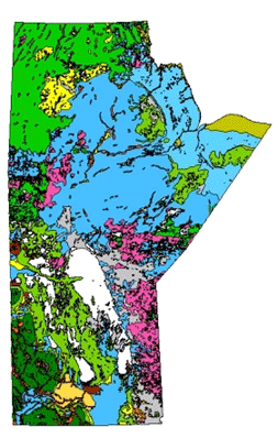 |
|
Instructions
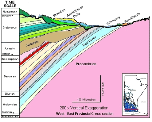
- Clicking on the words "Time Scale" will display a stratigraphic chart with descriptions of the units (several units have been grouped in the model).
- Moving the mouse over the geological periods listed under "Time Scale" will display a list of formations/groups underneath the scale.
- To select a formation/group from this list, move your mouse off of the time scale image and down to the menu. Selecting a formation/group will display the corresponding geology on the Map View.
- Clicking on the Map View will display a larger version of the map with legend; clicking on this image will bring up a printable PDF.
- The Cross-Section View illustrates all of the formations/groups except the Pierre Shale (Coulter), Boissevain, and Turtle Mountain formations. The cross-section is an east-west profile view through the major population areas of Manitoba.
- Clicking on the Cross-Section View will display a larger, fully annotated image.
- In the Cross-Section View the Quaternary has been subdivided into several lithological units.