The Assiniboine-Birdtail Integrated Watershed Management Plan
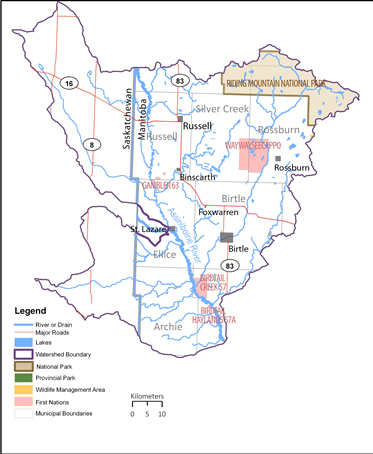
The Assiniboine-Birdtail integrated watershed management plan encompasses the area of land which contributes water to the Assiniboine River, including tributaries such as Birdtail, Minnewasta, Silver, Thunder, Deerhorn, and Scissor Creeks. The Upper Assiniboine Conservation District and Lake of the Prairies Conservation District are leading plan implementation in partnership with the Provincial government and a team of supporting agencies, interest groups and watershed residents. |

|
|
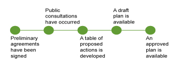
It takes approximately two years to develop an integrated watershed management plan. The timeline on the right illustrates plan development progress. Once a plan is implemented the water planning authority can publish reports which track progress on achieving planning goals. |

|
|
In the development of a watershed management plan the planning team invites a variety of groups to comment on issues important to them in the watershed. A summary of the issue summary and public comments are available to review. |

|
Public consultations are held to better understand the concerns and issues of the watershed. The results of the issues discussed at public consultations are summarized here.
The planning team asks technical experts and relevant stakeholder groups to provide information and issues about the watershed. A significant amount of valuable information is provided by:
Manitoba Environment and Climate Change
The planning team also works to review any relevant
Background reports in the watershed
- Habitat Monitoring Program (Environment Canada)
- Other Reports of Interest
Sometimes the technical information is summarized in a separate summary document, and sometimes technical information is summarized with the watershed plan.


