Cooks Creek Conservation District |

|
Back to Conservation Districts
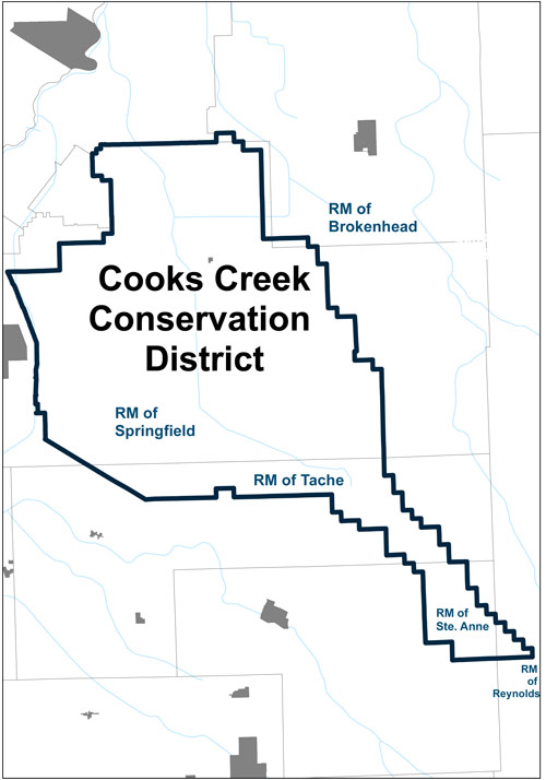
The Cooks Creek Conservation District (CCCD) was formed in 1979 to address local soil and water conservation issues. It was provided with an infrastructure mandate, and maintains a number of drains, crossings and bridges. The district lies east of Winnipeg and is 862km2 in size. It includes the majority of the Cooks Creek Watershed, which discharges into the Red River, as well as parts of the Carr's Creek and the Lower Seine River watersheds, both which flow into the Red River Floodway. The Devils Creek Watershed lies to the north east of CCCD. The district partners with several municipalities, and covers a large amount of the municipality of Springfield and smaller portions of the municipalities of Taché, Ste. Anne, Brokenhead, and Reynolds.
Topography is relatively flat, characterized by an eastern upland and central lowland area. An extensive man-made drainage system services the agricultural lands in the area. The CCCD offers several soil and water based conservation programs, with a focus on surface water management. The district is currently developing an integrated watershed management plan for the Cooks-Devils Creek Watershed.
Box 11, Group 561, R.R. #5, 66-156 Pineridge Road
Winnipeg, Manitoba, R2C 2Z2
204.777.2223 (P)
204.777.0570 (F)
http://www.cookscreekcd.com
cccd@mts.net