Northeast Red Watershed District |
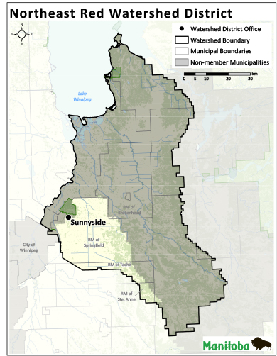
The Northeast Red Watershed District (NRWD) was formed in 1979 (as Cooks Creek Conservation District) to address local soil and water conservation issues. It was provided with an infrastructure mandate, and maintains a number of drains, crossings and bridges. The district lies east of Winnipeg and is 862 km² in size. The district partners with several municipalities, and covers a large amount of the municipality of Springfield and smaller portions of the municipalities of Taché, Ste. Anne, and Brokenhead.
Topography is relatively flat, characterized by an eastern upland and central lowland area. An extensive constructed drainage system services the agricultural lands in the area. The NRWD offers several soil and water based conservation programs, with a focus on surface water management. The district completed an integrated watershed management plan for the Cooks-Devils Creek Watershed in 2017.
66156 Pineridge Road
Sunnyside , Manitoba, R2R 0G9
204.777.2223 (P)
204.777.0570 (F)
nrwdmanager@mymts.net


