
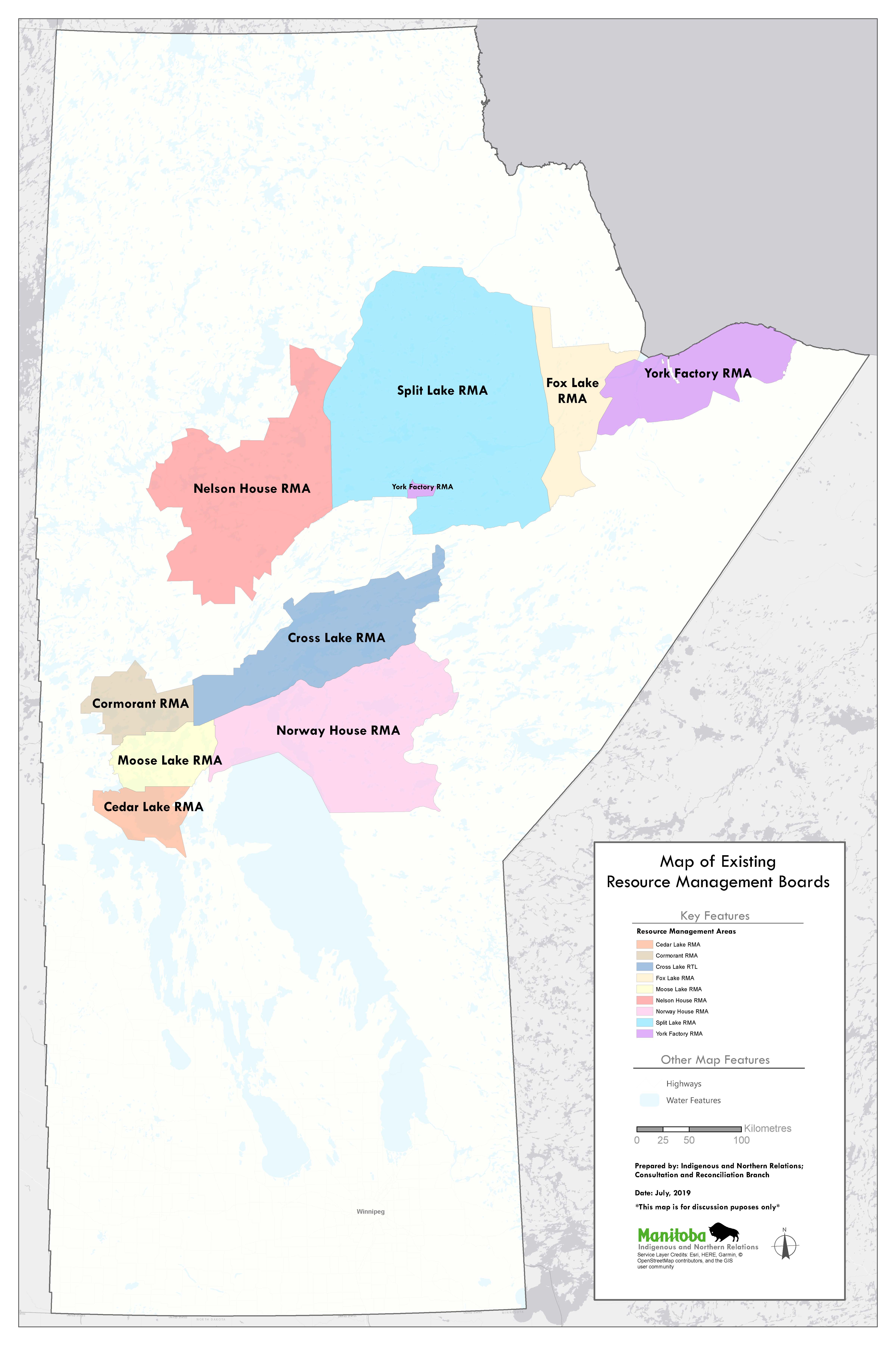
Resource Management Boards
Through the respective adverse affects settlement agreements (ex: Northern Flood Agreement, Grand Rapids Forebay and others), Resource Management Boards (RMBs) were established to co-manage the natural resources in defined areas (Resource Management Areas). Manitoba Indigenous Relations serves as the provincial lead in the management and implementation of the RMBs established under these agreements. Each of the ten existing RMBs are mandated to develop and implement land use plans and resource management plans.
The boards are responsible for approximately 35 million acres or 22 per cent of Manitoba’s Crown land base.
Prepared by: Indigenous and Northern Relations;
Agreements Management and Aboriginal Consultations
Source: Manitoba GIS Database
Date: July 2019
* This map is not final and is for discussion / illustrative purposes only *
Full size image
| RMA or RTL Name | Area (km2) | Area (Acres) |
|---|---|---|
| Cedar Lake RMA | 3759.38 | 928962 |
| Cormorant RMA | 4944.76 | 1221880 |
| Cross Lake RTL | 14676.3 | 3626580 |
| Fox Lake RMA | 8029.78 | 1984200 |
| Inuit-Dene Sub-Arctic RMA (Proposed) | 67511.81 | 16682530 |
| Moose Lake RMA | 4872.91 | 1204120 |
| Nelson House RMA | 22883.7 | 5654670 |
| Norway House RMA | 22012.1 | 5439300 |
| Opaskweyak Cree Nation RMA | 6212.86 | 1535230 |
| South indian Lake RMA (Proposed) | 33906.61 | 8378505 |
| Split Lake RMA | 43168.7 | 10667200 |
| York Factory RMA | 10623.96 | 2625230 |
| Total Area | 242602.87 | 59948407 |
| Total Area (excluding proposed) | 141184.45 | 34887372 |
| % of Manitoba land Base | 37.33% | - |
| % of Manitoba Land Base (excluding proposed) | 21.72% | - |