
Archives of Manitoba
Spotlight: HBCA in words and images
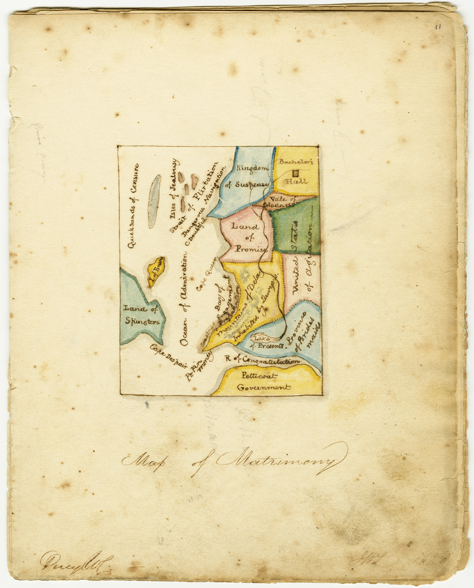
Love and marriage in a map
enlarge image
(HBCA E.98/7, fo. 11)
This map of matrimony is found in a nineteenth-century autograph book that belonged to Olivia Dewey of Cramahe Township, Upper Canada. The map was signed by “J.W.L.” but the name of Olivia’s apparent ‘suitor’ is not known. Olivia appears to have been a friend of Maria McTavish and somehow the book must have come into Maria’s possession, or that of her family. The book is signed by Maria and forms part of the McTavish and Campbell family fonds. Search Keystone for more information on these records.
Maps depicting the geography of love and marriage come out of a tradition of fantastical allegorical maps which depict themes such as faith, morality, love and the paths of life, dating back to the late eighteenth century. Maps of matrimony were popular themes for nineteenth century Valentine’s Day cards. They portrayed the various stages of love to marriage with such geographical features as “Ocean of Admiration” and “Strait of Flirtation,” which progress on to the “Bay of Engagement” and the “Lake of Presents.”
See past features in: Spotlight Archive