
Manigotagan River Provincial Park
Eastern Parks
Manigotagan River Provincial Park, Manitoba’s 80th provincial park was designated on December 1, 2004.
The park is located about 150 kilometers northeast of Winnipeg. The Manigotagan is a challenging whitewater river just hours by road from the population centre of the province. The community of Manigotagan sits at the river's mouth, on the shore of Lake Winnipeg.
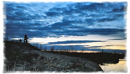
The park is composed of a corridor stretching 45 kilometers from the north-western tip of Nopiming Provincial Park downstream, ending just outside the community of Manigotagan. The topography is as varied as it is spectacular, ranging from sheer rock faces topped with craggy Jack Pine and Rock Tripe lichen on the upstream stretches, to moist verdant stands of Balsam Poplar, Green Ash and Elderberry near the river mouth. If you look carefully, you may even find Prickly Pear Cactus, Canada Yew and some of the area's majestic wildlife moose, black bear, wolf or woodland caribou - highlights of a trip to be savoured under evening displays of the Aurora Borealis as the river slips by. The Manigotagan River is classified as a natural park and is composed of two land use categories. Over 99% of the park's 7,432 hectares are backcountry (the area is protected from mining, logging and hydro-electric development). Less than one per cent of the corridor, or 16 hectares, is classified as recreational development. The corridor contributes to the provincial protected areas initiative.
Archaeological surveys conducted over the years have revealed thousands of artifacts indicating this important river corridor was utilized by the Blackduck and Laurel cultures as far back as 2200 years ago. Since then the Manigotagan River has also been used by trappers, loggers, and gold miners as a route to the natural resources of the region. Rusting log boom anchor bolts, an occasional trappers cabin and an “Alligator” (an unique, ill-fated piece of mining equipment) have joined the more timeless portage routes, campsites and ancient pottery shards that mark the past chapters of the river’s history for today’s observant river traveller.
Caution! The Manigotagan River is a challenging, yet rewarding wilderness experience, and should only be travelled by experienced paddlers and backcountry campers. The route receives minimal maintenance and portages and campsites may be difficult to find. Users should be prepared to traverse challenging terrain.
Where to Stay
There are some first-come, first-serve canoe access (backcountry) campsites available along the river. Some sites have very minimal amenities (fire ring).
Two operators provide Hotel/Motel accommodations in the community of Manigotagan, and there is a small municipal campground next to the river adjacent to the community that is open in the summer.
Park Directions
From Winnipeg, follow PTH 59 north to PR 304 to Manigotagan (Community)(170 km). Continue along PR 304 east towards Bissett (88 km/54.7 mi). Near Bissett, there is a small access road leading to Caribou Landing, the closest canoe launch to the new park.
Resources
Manigotagan Trip Planning Guide
 Manitoba
Eco-Network has developed an interactive web-based GIS mapping
tool providing a wealth of information about the Manigotagan
River. This digital map can be viewed online and is designed to
assist with trip planning. Users can retrieve valuable
information, pictures, and documentation of rapids, portages
and campsites. The mapping tool also provides facts about
the river, environmental sustainability and emergency information.
Manitoba
Eco-Network has developed an interactive web-based GIS mapping
tool providing a wealth of information about the Manigotagan
River. This digital map can be viewed online and is designed to
assist with trip planning. Users can retrieve valuable
information, pictures, and documentation of rapids, portages
and campsites. The mapping tool also provides facts about
the river, environmental sustainability and emergency information.
![]()
![]()
![]()
A local service in Manigotagan (community) ferries canoeists' vehicles from their selected drop off point on the Manigotagan to their point of exit from the river at the community.